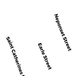
178 NEPONSET STREET
Owner Information
CREECH, DEBORAH F
178 NEPONSET STREET
NORWOOD, MA 02062


Property Details
178 NEPONSET STREET is classified as a Single Family Residential (Colonial).
The primary structure on this property was built in 1998. There are 2,940ft2 of built area within this property. There is 1,768ft2 of residential/living space within this property. This property is listed as having 7 rooms.
178 NEPONSET STREET is valued at $533,100. The land is valued at $216,000 and the structures are valued at $315,500. There is an additional valuation of $1,600 on this property.
This property is in Zone G. Confirm with local Zoning Board authorities to ensure there are no overlays or other easements on this property.
The most recent deed for 178 NEPONSET STREET is recorded at the local registrar in Book 12472, Page 0579. 178 NEPONSET STREET was last sold on Friday, May 1, 1998 for $239,900.
Assessment data from fiscal year 2022.
Flood Data
According to the FEMA National Flood Hazard Layer, this property does not appear to be in a flood zone. It may also be in an area not yet reviewed. Nonetheless, confirm this information prior to taking any action.
To view the flood hazards around this property, create a FEMA "Firmette" Map of the area around 178 NEPONSET STREET.
Broadband Internet Providers
| Provider | Type | Bandwidth (mbps) | |
|---|---|---|---|
| VSAT Systems, LLC. | Satellite | 2 | 1 |
| HughesNet | Satellite | 25 | 3 |
| GCI Communication Corp. | Satellite | 0 | 0 |
| Comcast | Cable | 1000 | 35 |
| Verizon New England Inc. | Fiber | 940 | 880 |
| Verizon New England Inc. | DSL | 7 | 0 |
| Viasat Inc | Satellite | 100 | 3 |
Broadband service provider data from December 2020.
Adjacent Properties
- 186 NEPONSET STREET
Single Family Residential owned by JENKINS, DAVID B - 172 NEPONSET STREET
Condominium owned by WONG, JOHN - 174 NEPONSET STREET
Condominium owned by WONG, JOHN - 172-174 NEPONSET STREET
Other, Open Space owned by WALSH, ANTHONY L - 277 BOSTON-PROVIDENCE TPKE
Automotive Vehicles Sales and Service owned by BOSTON PORT SERVICE INC